The parish of Wokingham Without dates from 1894 when it was formed as a new Parish cut from what had previously been administered from Wokingham town, however to look at its wider history we must consider the land it occupies, not who administered aspects of its management.
The name “Wokingham Without” describes an area of outer Wokingham, as opposed to inner (within) Wokingham, and originally appeared somewhat like a reversed “C” shape, more rural in character than inner Wokingham’s developed town; in addition to the Wokingham Without of today, it continued around the east side of Wokingham town, extending north to just beyond Forest Road, its easternmost part abutting the parish of Binfield, whilst the westernmost end of end of Forest Road included the gates of Bill Hill house, and the Countess of Leicester road subscription monument. Although it surrounded Wokingham on three sides, it never extended to its northwest or west sides. It abutted the parishes of Hurst, Binfield, Easthampstead, Finchampstead, and of course Wokingham.
The Wokingham without of today is roughly contained within a rectangle starting from the railway bridge on Luckley Road and following the Wokingham to Crowthorne railway line as far as a point near the Devil’s Highway to the south of East Berks Golf Club, it then takes the line of the former Devil’s Highway through to the junction of Bracknell Road and Old Wokingham Road; following Old Wokingham Road north into Peacock Lane until just short of Waterloo Road it cuts across the corner and continues over Waterloo Road in a straight line to the Wokingham to Bracknell railway line, and then back towards Wokingham until just beyond Ludgrove School, it stops short of Lucas Hospital and cuts diagonally back to the Luckley Road bridge. To avoid complications, this history will refer mainly to the area and near surrounds of present day Wokingham Without.
Archaeological finds have been varied and range from a Neolithic polished flint axe head, to small stone -age tools of other sorts, pottery fragments from mediaeval times and later, and earthworks of varying ages possibly including Roman.
One of its earliest features is the survival in part of the Roman road known as Devil’s highway, whilst largely surviving intact between Bagshot and Crowthorne, it has only piecemeal portions between the junction of Old Wokingham Road/Bracknell Road junction, and its line towards the Lower Wokingham Road. Much has been lost to housing development, a substantial portion (apparently with no archaeological research) when Edgcumbe Park was built in the 1960’s, however the significance of its line has remained to this day as it broadly speaking forms the dividing line between the Parish of Wokingham Without and the Parish of Crowthorne, with this division also marking the distinction between Wokingham Borough and Bracknell Forest. So the deciding factor as to whether you reside within Wokingham Borough or Bracknell Forest, depends on which side of an almost 2,000 year old road you live upon.
The next major influence on the area followed the Norman Invasion of 1066. When the new King, William 1st, built a fortress at Windsor he designated Windsor Forest as a royal hunting ground, this not only brought added status, it also heralded more regulation. The boundaries seemed to change over time but are accurately recorded by the 1600’s when the forest was in the region of 80 miles in circumference and included around 20 parishes. Many Hamlets and villages were within its boundaries, and also the larger towns of Wokingham and Windsor. Windsor Forest as a royal hunting ground did not mean the crown wholly owned Windsor Forest, but that the whole area was governed by strict forest laws that controlled many activities within its boundary. The laws were intended to benefit the livestock that lived within the forest, particularly deer, which was reserved for the hunting pleasure of William and subsequent Kings and Queens. This meant not only the control of unauthorised hunting, but also restriction on enclosures or obstacles such as fences, and protection of the greenery and landscape within its bounds. Windsor Forest was divided into a number of areas called “Walkes”, each looked after by its own keeper, Wokingham Without is situated in what had been Bigshotte Walke, an area that covered most of present day Wokingham Without, Finchampstead, Swallowfield, and part of Wokingham; it was bounded on its southern edge by the River Blackwater, a feature that also marked the boundary of Windsor Forest.
It is likely that many of the older public routes that survive today originated as Windsor Forest tracks or rides, some becoming main roads, others surviving as byways or footpaths, whilst the remainder have just disappeared or been developed over. An example of a route that has become a main road is Nine Mile Ride, whereas Hatch Ride, a section of what originally was a much longer track, has variously become a tarmacked road, survives as an unmade byway, or been lost to development; it originally continued its line across what was the Road Research site, now a business park and Butler Park housing development.
Another route lost entirely is that of Godewykes Lane, this ran just north of present day Gorrick plantation, and linked the Evendons area to a lost settlement called Southleghe, believed to be somewhere near Gardner’s Green (near Home Grange School) and Honey Hill. Whilst not immediately obvious, the name Godewycke has not been entirely lost, but changed. Different spellings and miss-interpretations over the centuries transformed Godewyke – Go**yke to Gorrick . Godewykes was recorded locally by name in the 13th century referring to a moor or pasture; who Godewyke was is not known but it is a name with possible Anglo Saxon origins, so could be the earliest derived name in the area to have survived. Present day Gorrick plantation was not always the woodland we see today as it had largely been part of the extensive heath referred to in the paragraph below, it was also notable for the area in which Gorrick Well was sited, a feature long since filled in and lost, but reputedly a source of healing water. It was said to be rich in Chalybeate, an iron rich solution, which was thought to be beneficial to the eyes among other things, certainly not to be considered today. Legend has it that Queen Elizabeth 1st visited the well on more than one occasion to bathe her eyes, this could be true as it is recorded she had eye problems and would also have had the opportunity given the relatively short distance from Windsor Castle & the very local Royal Lodge of Easthampstead Park. Local streams can sometimes be seen appearing like tomato soup, this is due to the rich presence of iron in the ground and was probably the feature that captured people’s attention at Gorrick.
Whilst today we think of Forest as woodland, it originally meant hunting land, and Windsor Forest would have comprised of parkland, woodland, farmland, grassland, scrubland, heathland and areas of bog. Early descriptions of the area now within Wokingham Without suggest rather poor quality land, and to a large extent, relatively open heath. In 1612, Easthampstead Park Estate was described as heathy and barren, but with a reasonable stand of trees. The area around Caesar’s Camp was part of Bagshot Heath, described as a barren heath, a landscape that would have extended through to parts of Finchampstead. As well as heathland there would have been ponds, scrubby woodland, thick covert, but also some substantial old trees. What would have been very different is that whereas today there is a substantial number of Scots Pine trees, these were a later addition, and up to the 1800’s the woodland would have been dominated by species such as Oak, Elm, Ash, Beech, Birch, Yew and a variety of other smaller hardwood trees.
Undoubtably one of the most important properties of the area was Bigshotte, not the later Bigshotte between Nine Mile Ride and New Wokingham Road that some may remember as Bigshotte School, but the original Bigshotte that is now the site of Ravenswood Village. Bigshotte was a royal enclosure for deer, either Red or fallow, but most likely the former; it would have been a fenced enclosure within which was a substantial house for the royally appointed keeper, often a person of importance who was more of a figurehead, and a second (lesser) dwelling for the under keeper who did most of the day to day work. The original date of its founding is as yet unknown, but it was in existence by the late 1500’s; as a landscape it survives to the present day very much intact, albeit with its historic houses now gone and a small development of buildings in their place. Within the grounds of the present village survive some of the area’s oldest trees, easily dating back to the days when Windsor Forest was still a royal hunting ground, their survival is very rare and something of great merit.
Wokingham Without has historic buildings that date from the 1400’s, the earliest were once open hall houses, that is where the fire hearth was an open arrangement (without a chimney) set within a large open hall of the house, by the late 1500’s this was no longer the way of building and chimneys had become commonplace, there are a number of buildings from the late 1500’s and 1600’s, still enjoying surroundings little changed from the days they were built, although pressure for development means that some will soon be surrounded by modern houses. Luckley House was the only house on a grand scale, home to the Duke of St. Albans, and the centre of what became a large estate extending into Finchampstead, although this was demolished in the mid 1800’s; Ludgrove now occupies a nearby site.
Population remained minimal throughout the 1700’s and was mainly home to a few farms and their farm workers, Bagshot Heath like many other such places was generally an inhospitable environment, there is a description of sheep grazing on nearby heathland in Finchampstead, and even these were described as poor specimens, the impression being given that they could barely find enough food to survive, and there were concerns expressed in the 1700’s that overgrazing by sheep may have been adversely affecting the grazing opportunities for deer.
It is highly likely that highwaymen of sorts were an occasional risk to those crossing the heath. John Gay the writer wrote of crossing the heath “Prepare for war now Bagshot Heath we cross, where broken gamesters oft’ repair their loss”. In the early 1700’s there are records of fences being damaged by poachers at Bigshotte, presumably to get access to the deer within. Other illegal activities included cutting and taking turf (used as fuel for fires), stealing from fishponds, killing free roaming game, encroaching properties into open land, and intimidation. In 1723 the notorious Black Act was passed in an effort to stop poachers and other criminals blacking their faces as an aid to disguise and camouflage, this introduced a number of new capital offences. It was a problem not only in Windsor Forest, but in Hampshire, Richmond, Enfield, and elsewhere. Locally there was a particularly notorious group known as the Windsor Blacks, more locally as the Wokingham Blacks. They were a mixture of local businessmen, farmers, craftsmen, and labourers, one of the accused was a Wokingham Clockmaker (although he was eventually cleared of the offence). Whether they were out and out villains, local people short of food, or established residents with a legitimate grudge, is subject to debate; they were probably a mixture of all three. There were certainly some who were resentful of newly arrived wealthy landowners who took advantage of their positions by removing access to lands which locals had previously enjoyed free use of. Eventually a trap was set for the gang, which led to the apprehension of a number of their active members, at least four of whom were subsequently given the death sentence and hanged, legend has it within the nearby forest. Wishmoor Cross near Caesar’s Camp was reputably the site of a gibbet, and could have been one of those used, the spectacle intended to deter others from breaking the law.
Throughout the centuries Windsor Forest had been a source for timber used in building construction, fuel and probably shipbuilding, however it is hunting that it is most well known for. Queen Anne was reputedly keen on hunting and in later life drove herself in a chaise, which probably meant keeping to the forest rides, and there are also records of later Kings and their entourages hunting through this area. With regard to Bigshotte, even in the mid 1700’s the fence rails were still in place and being repaired, however it seems that the importance of Windsor Forest declined as the 1800’s approached, although stag hunting was still an important pursuit.
Huge changes took place with the Windsor Forest Enclosure act of 1813. This meant that large expanses of unenclosed land, much of which had been used for centuries by ordinary people to gather firewood or graze livestock, would be allotted to established landowners and become their private property. The amount of land that would be allotted was dependent on the freeholders existing landholding, the more you had, the more you were granted. If you owned nothing, you were granted nothing. Many would find their long enjoyed right to graze animals and supplement what may have been a poor life, disappear overnight. Only in some places did common land survive, elsewhere small parcels of land were designated for the poor, often as fuel allotments. The new enclosures were intended to ensure that less land was unproductive and provided opportunity to expand farms, grow more crops, or establish tree plantations. Throughout the mid and later 1800’s, many tree plantations were established in this area, however most were Scots Pine planted as a crop, rather than the slow growing hardwoods that would have been the historic species of the area. The pine trees that are so prevalent within the area today have their origins at this time, even if they have been harvested and replanted on one or two occasions since. The famous 18th/19th century commentator William Cobbett, disliked the look of these new pine plantations, thinking them as ugly as the heaths on which many were planted. The scenery would have changed forever, in present day terms we see not Pine plantations changing the landscape but housing developments.
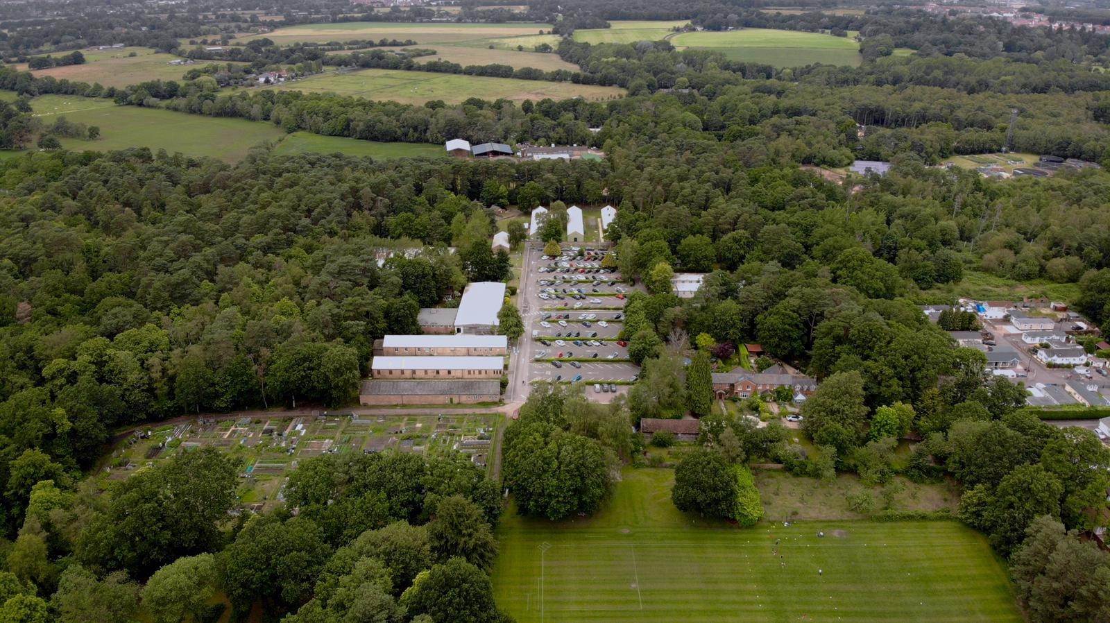
During the second half of the 1800’s, the future Wokingham Without area began to change. In addition to the introduction of large pine plantations, Bigshotte ceased as a crown property and became a private residence, and in 1849 the railway line trimmed the edge off Bigshotte’s park. Crowthorne was established as a built settlement promoted by the building of Wellington College and Broadmoor. At least two small brickyards existed, one in what is now East Berks Golf course, another on the site of The Pinewood Centre’s football pitch with a clay quarry on the opposite side of Nine Mile Ride.
A group of people known as broomdashers, who made their living from the heathland and scrub woodland around Gorrick, lived somewhere between the railway line and Heathlands Road. Apparently their dwellings were considered of the most rustic and basic kind. Their principal business was the manufacture of besom brooms which they made with much skill and in huge quantities to be sold both locally and also for transportation to larger markets elsewhere. When the railway was established in 1849, this must have made it much easier to transport their products to more distant markets. The land would most likely have included large areas of coppiced birch, as this is the common material to make the brush from, although sometimes heather could be used (this was more of a northern way of making them). It is most likely the broom making was seasonal and they also did other work, as the availability of the material needed was also seasonal. Local legend suggests they were hard working with a tough constitution, and perhaps some were also hard drinking and somewhat heathen, as it was reputedly this group of people that were one of the main reasons for building St. Sebastian’s Church, to encourage them to live a more sober and Christian way of life.
St. Sebastian’s Church was consecrated on 10th of December 1864. It was built on land donated by Mr Sawyer of Ravenswood House (formerly Bigshotte) and funded by donations from local well to do people. The church was designed by William Butterfield. Further enhancements were made during the 1880’s including the addition of the bell tower. The ecclesiastical parish of St. Sebastian’s was not formed until 1871, prior to which it had been an outlying part of All Saints, Wokingham. The neighbouring school was built six years after the church, although there had apparently been a small building on the Ravenswood estate used for schooling that predated the church by a couple of years. The churchyard has memorials to some of the wealthier local families, but also the official war graves from WW1 and WW2. A number of the 1st WW graves were associated with casualties that had been in Pinewood Sanatorium (see below). The more recently established cemetery lies adjacent to the churchyard
Public Houses were plentiful given the small population of the area, and this suggests they were an important part of life for many locals. After a hard day’s work in rough surroundings and the most basic of dwellings to return to, there would have been few other options for socialising and entertainment. The first date they appear on official records currently know about are as follows: The Crooked Billet (1842 – to the present day), The White Horse (although not showing as a public house on the 1871 OS map is recorded in 1848 and still operates to the present day), The Spotted Cow (1848 – 1872), The Forester (aka The Pig & Whistle (1850- unknown but closed by 1898 ), Dog & Partridge (already in existence by 1871, closure date unknown but no longer operating by 1898. Who’d a Thot It (although not showing as a public house on the 1871 OS map, recorded as 1861 –closure and demolition circa 2003). The Who’d A Thot appears in a couple of scenes in the early 1950’s film “Bang your dead”, as does nearby Heath Lake and a group of hut homes at Easthampstead,.
Private Lockhart
Whilst now just outside Wokingham Without, Soldiers Rise had been part of the parish until the 1970’s. The story of Private Lockhart is an example of how a small reminder can keep history alive. A simple but poignant memorial is sited at the Lower Wokingham Road End of Soldiers Rise. It records that private Robert Lockhart died close to the spot in (18?5/6?). It is set into a granite plinth with brief details on its face and was put there by Wokingham Without Parish Council to replace a much decayed concrete plaque that was found close to the site. It records that Private Lockhart died whilst on a march from Farnham to Reading. The information is minimal, however there is more to know; in Wokingham’s Baptist church, another grander memorial paid for some years after his death by donations from his regiment records Private Lockhart as being in the Scots Greys, and it gives more information about his military service, recording him as fighting at the battles of Tournay, Inkerman, and Balaclava. It is believed he joined as a boy soldier, which suggests the army had been the greater part of his life. He had obviously been a professional soldier of great experience and it would appear well loved and respected by those around him. But for that one obscure memorial, his story would have been lost.
Heathlands House, a large country house, was built in the 1860’s, it was occupied for many years by members of the Palmer family (of Huntley & Palmer biscuits). It was they who excavated the ground for Heath Lake built sometime between 1898 & 1910, and it is likely the clay excavated was used by a newly established brick works nearby at the junction of New Wokingham Road and Oaklands Lane. The house was converted to flats in the late 20th century and finally demolished to make way for a new housing development. The original coach house and walled garden remain.Last Updated on 31st January 2024


